West Ridge Downtown Connection
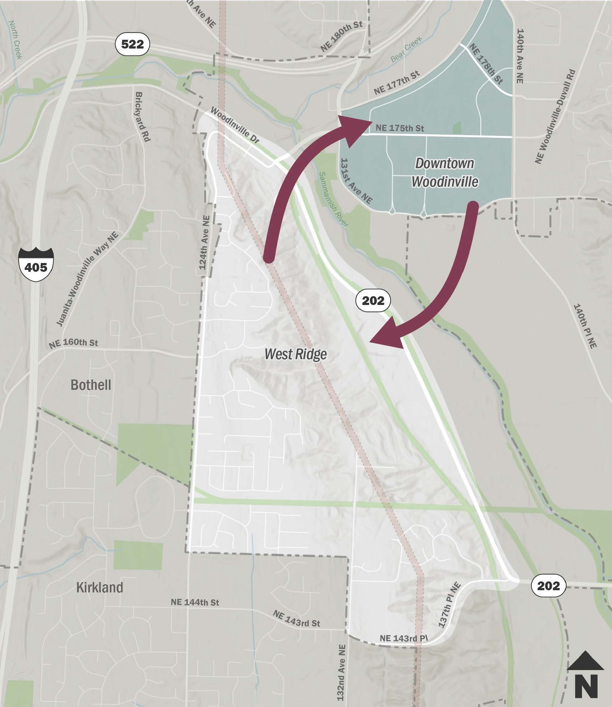
The West Ridge neighborhood is located on the southwest side of Woodinville along a steep north-south ridge, while Downtown is located in the Sammamish River Valley. Slopes exceeding 20% grade separate the two areas, creating significant barriers for pedestrians and cyclists.
Existing Conditions
- 124th Ave NE to NE 173rd Pl in the north. This route does not include sidewalks or pedestrian facilities along the slope.
- NE 143rd St / 137th Pl NE / NE 145th St (“Winery Hill”) in the south. Sections of this route include sidewalks and pedestrian facilities. Remaining gaps may be addressed through frontage improvements associated with upcoming and future residential development or City-led capital improvement projects.
The two connections are approximately 1.5 miles apart. The southern route primarily connects West Ridge to the Tourist District rather than directly to Downtown.
Potential Connection Opportunities
The Tolt Pipeline Trail, located approximately 0.25 miles north of NE 145th Street, offers another potential pedestrian connection. However, the corridor currently lacks key roadway and State Route crossings. Several crossing improvements have been identified in the City's Capital Improvement Plan (CIP) but remain unfunded. The surrounding network also includes multiple collision hotspots and accessibility gaps.
In 2024, the City added a study of potential connections between West Ridge and Downtown to the 2025/2026 Biennial Budget. In February 2026, the City retained Parametrix, one of its on-call engineering consultants, to evaluate potential connection opportunities.
The initial screening identified six possible alignments. Three remain feasible for further consideration:
- 124th Avenue NE
- 124th Avenue NE to NE 173rd Place
- 124th Avenue NE to Kirkland Spur via Winery Hill
On May 28, 2026 City staff presented the evaluation results to the Public Spaces Commission for preliminary feedback. The Commission generally favored trail-based alternatives. On June 16, 2026 City staff provided an update to the City Council.
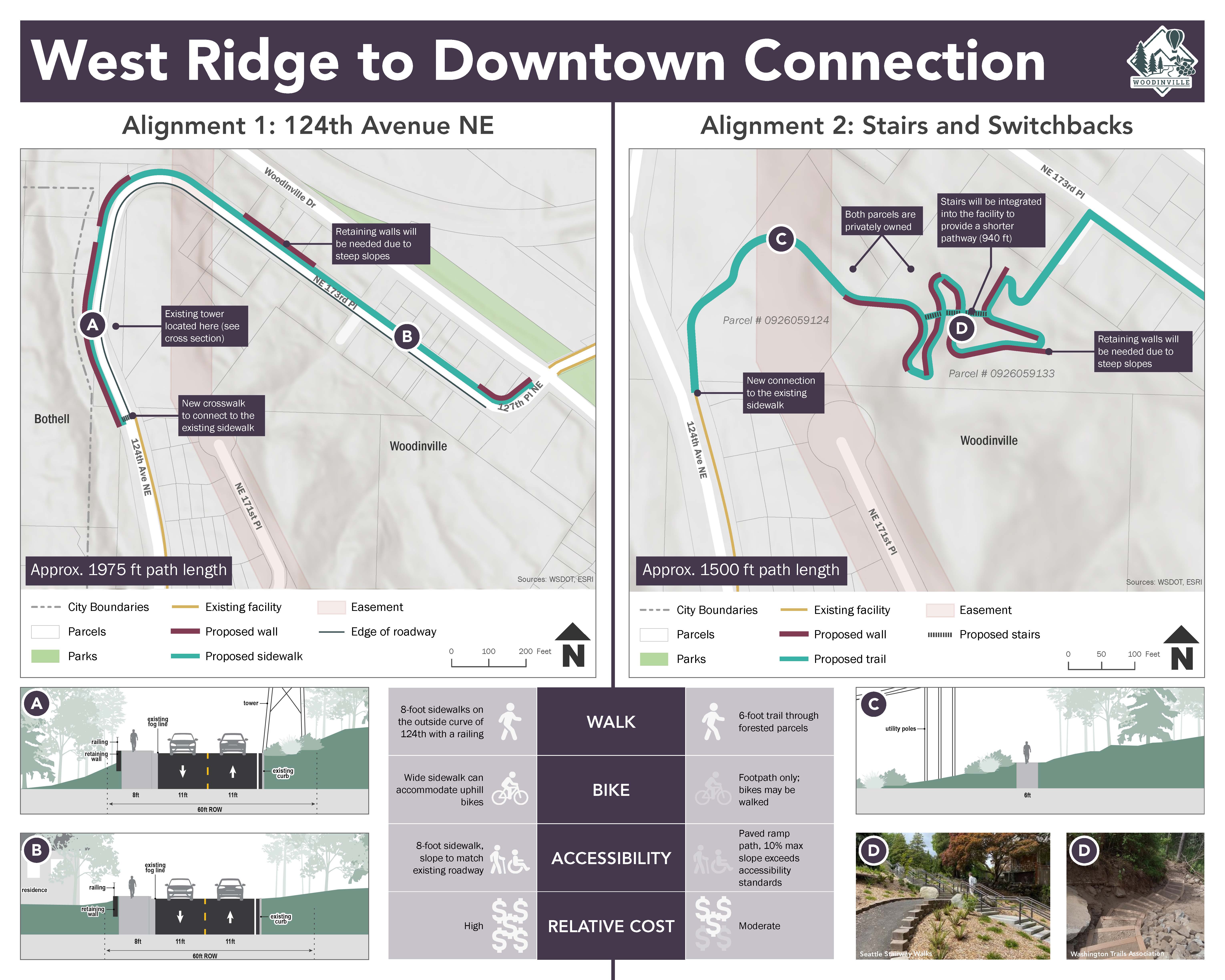
The City is considering two potential alignments.
The City conducted a survey to gather the community's feedback on the potential route they preferred. The survey ran from August 17-September 7, 2026. The results will be shared with the City Council and public at a future City Council meeting.
Next Steps
Parametrix will refine the potential alignments, prepare a preliminary cost estimate, and develop a conceptual design for the preferred alignment. City staff will share the conceptual design with the West Ridge neighborhood for feedback before returning to the City Council with a recommended alignment, cost estimate, and conceptual design.
-
Engineering Division
Phone 425-489-2700 Email pwprojects@woodinville.gov