Eastrail Corridor Project
The Eastrail Corridor Project represents a bold investment in Woodinville’s future - transforming a dormant 1.9-mile rail line into a dynamic multi-use trail and linear park that weaves through the heart of the city. More than a trail, the Eastrail Corridor Project is a catalyst for connection - linking neighborhoods, supporting local businesses, and shaping a healthier, more vibrant Woodinville.
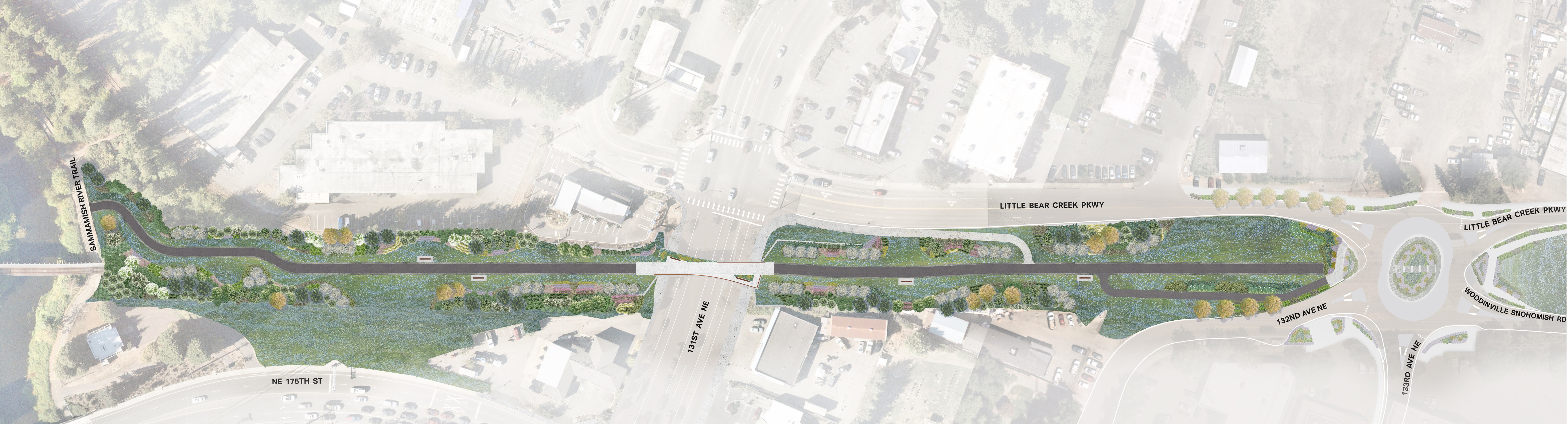
Beginning at Wilmot Gateway Park, the corridor will extend north through downtown Woodinville to the city limits, creating a vibrant public space where residents and visitors can reconnect with neighbors, nature, and the community itself.
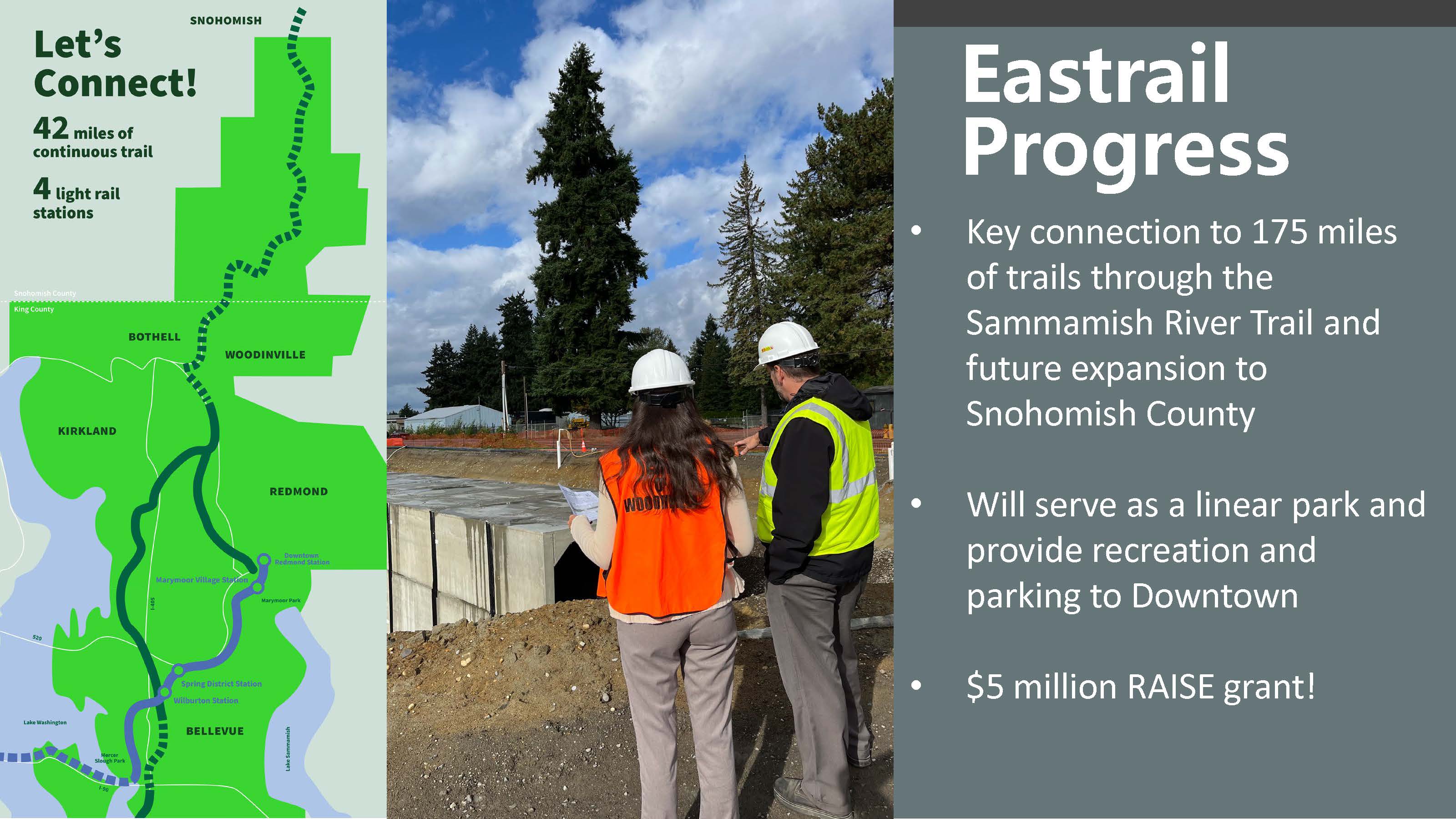
Upon completion, this segment will link Woodinville to the 42-mile Eastrail network - connecting Renton to Snohomish - and providing seamless access to the Sammamish River Trail as well as the future Centennial Trail extension in Snohomish County.
Planning & Design
The planning and design of this project will be organized into three phases.
Phase 1 includes planning, conceptual design, and the creation of a framework plan. Phase 2 will complete the preliminary design and environmental review of the recommended trail alignment and amenities. Phase 3 will complete the final design and permitting for the trail.
The framework plan will set a foundation for the project and the future phases, including trail alignment alternatives, a cultural plan that identifies existing or new community assets to connect to the corridor, and options for phasing investment and construction of the project over time.
Next Steps
Public engagement will be a central component to the design process. The Project Team will kick off a series of outreach events and opportunities for public feedback in spring/summer 2026. Understanding the public's priorities will help the Design Team develop a framework plan that reflects the diverse needs of Woodinville's communities.
Anticipated Schedule
- Phase 1: Development of the framework plan will take approximately one year.
- Phases 2 and 3 of the planning phases: The City will move forward with securing additional funding for the construction phase after planning is complete, with the goal of completing the corridor within the next decade.
Key Benefits
- Safer Downtown Connections: Grade-separated crossings create safe, seamless access to neighborhoods, businesses, and regional trails.
- Improved Traffic Flow: Strategic upgrades—including modern roundabouts—reduce congestion for drivers, transit, freight, and emergency services.
- Greater Access to Transit & Nature: Walkable links to transit and green space encourage low-carbon travel and healthier daily routines.
- Healthier Community: A welcoming, multi-use trail promotes walking, biking, and outdoor activity for all ages and abilities.
- Economic Vitality: Increased foot traffic supports local businesses and expands access to jobs and services.
- Inclusive by Design: Fully ADA-compliant infrastructure ensures accessibility for people of all abilities and backgrounds.
- Environmental Resilience: Enhanced stormwater management and flood mitigation improve water quality and strengthen climate preparedness.
Community-Driven Design
This trail is being designed with - and for - the community. Public engagement is central to shaping the corridor’s identity, amenities, and priorities. Community members, local organizations, and tribal governments are all playing a role in determining the vision for this space, including input on:
- Public art and corridor branding
- Types of park features and recreational zones
- Design of crossings, gateways, and gathering spaces
- Wayfinding, safety features, and environmental stewardship
Contact Us
-
Engineering Division
Phone 425-489-2700 Email pwprojects@woodinville.gov
Eastrail Highlights
-
 From Renton to Snohomish, Eastrail connects communities with a 42-mile bike and pedestrian trail connected to transit.